| Distance | 251 Kilometers |
| By | Juanjo Diaz de Argandoña |
| Camera | Nikon D5100 @ ISO125 – 1/1000 |
| Lens | ED80 APO Refractor Telescope (900 mm. equiv.) |
| Date | December 7th 2014 – 16:30 |
Want to try yourself? Don’t forget to check our recommended cameras!
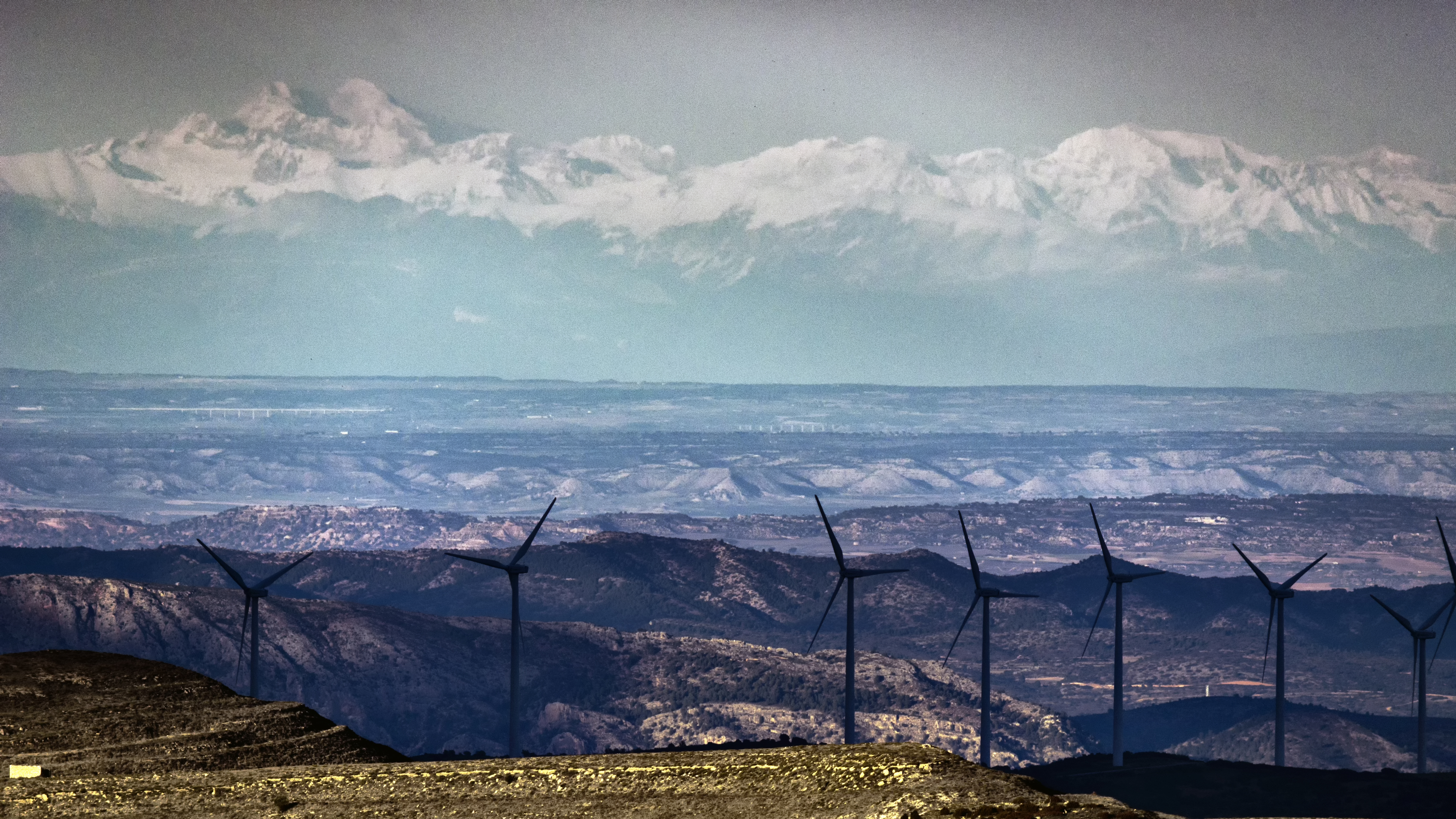
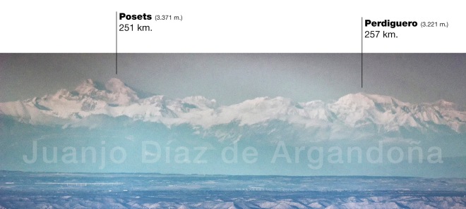
Clear air conditions above Ebro river and surrounding areas allowed to cover more than 250 kilometers and still mantain details of Posets peak and Perdiguero peak on the right side of the image.
Once you get to Cantavieja, at around 1.400 meters above sea level, there is a road that goes to Mosqueruela, and goes up to the highest part of Maestrazgo mountains.
400 meters above Cantavieja, the road starts to descent, so it is the time to turn left and start going through a county road, and park the car and see the views, uncovered by any mountain range to Pirineos, more than 250 kilometers away to the North.
The actual location is an small hill next to the upper part of the abovementioned road, called “Talayuela”. Its just a 20 meters up walk from the road.
Exact coordinates are: 40.4925 N 0.412 W
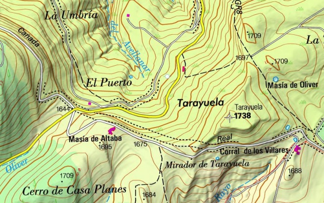
The discovery of this fantastic location came after days of researching in several maps online, looking for the best place to see the Pyrenees. In the map above, the yellow road is the one that cames from Cantavieja to Mosqueruela, and the white one goes to Talayuela peak, at the left of the image.
When I finally arrived there, the surprise came as a day with perfect visibility.
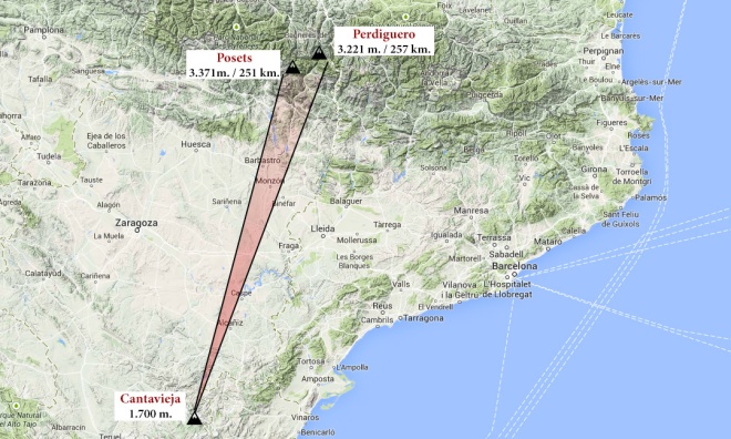
Several summits from Pirineos range could be seen rising above the horizon to the north, while the best conditions where around Posets peak. This mountain is located near Benasque village, just in the middle of Posets – Maladeta natural reserve, with other relevant mountains as Perdiguero (3.221 m.)

Pingback: Visións de l’illa des de el Montseny i des de Montjuic. Contemplació serena en el primer cas i recerca “agoserada” en el segon: La cota mínima de visibilitat. | Horitzons llunyans
Me encanta ésta, Juanjo. Es sobrecogedora. Me estás descubriendo un montón de maravillas -¡al lado de casa!- que desconocía por completo.
LikeLike
Gracias Ferrán!
He actualizado con el lugar concreto, por si algún día te animas a ir… Y si no montamos una excursión un día, es impresionante!
LikeLike
Pingback: Cantavieja – Vignemale | 254 km. | Beyond Horizons
Pingback: Welcome – Beyond Horizons